Monday, May 31, 2010

May 31, Memorial Day. The same air that raced mercilessly from the northeast yesterday turned around and came back from the southwest today, helping us do the 97 miles from Clayton NM to just outside of Guymon Oklahoma. Was foggy in the morning but turned out to be a good cycling day. After dinner we witnessed a good old-fashioned Oklahoma thunderstorm, with everything but the tornado. Sure glad we weren't out in it!

We were going to go into Texas first just to say we did, but it was a gravel road so we went straight for OK.Add ImageThe Rockin' A Cafe in Boise City Oklahoma, where we had second breakfast. Carrie recommends the homemade cinnamon rolls.

Somebody once told me cycling was easy on the knees....
May 30. 84 miles from Springer to Clayton NM, the last 65 miles into a 20-30 mph headwind. Cool temps and clear skies, and endless green prairie with lots of antelopes racing around, but the wind sucked a lot of the enjoyment out of the ride. Took us 91/2 hours and we were too 'winded' to take any pics.

May 29. Taos to Springer NM, 75 miles. Went through an extraordinary mix of countryside today, from sagebrush desert to high mountain meadows to steep canyons to the great plains. Got off at 6:30 AM and had no problems with traffic. We were going to stop at Cimarron Canyon st park still in the mountains, but this being Memorial Day weekend there were no sites available so we did tomorrow's trip as well since we were feeling good, even after summitting out at 9120 ft over the Sangre de Christo mountains this morning. For scenery this was one of the best legs of our trip. Great weather and a tailwind once again that fairly blew us along on the prairrie. Saw some pronghorn antelope on the high plains between Cimarron and Springer. Staying at a quaint RV park in Springer, which doesn't have much going on.


A pastoral scene in the Sangre de Christo mts east of Taos.


Heading down Cimarron Canyon towards the plains.

Thursday, May 27, 2010


May 27. Biked from the campground to Taos, mostly downhill, 54 miles. Beautiful scenery and weather in the mountains in the morning, we tried to stretch this ride out as long as possible. Down on the windswept, desolate sagebrush flats between Tres Piedras and Taos, we overtook a long-haired young man walking his beat-up bicycle along the road in the same direction we were headed. Said his name was Nobody, and he was heading into Taos to get some parts for his generator somewhere up in the hills. Seems he was having mechanical problems with his shifters but politely refused our offer of assistance. Carrie noticed his water bottle was almost empty, so offered water and an energy bar. He accepted, and by way of gratitude he recited some poetry for us there on the dusty highway. I don't remember the lines, but it seemed pretty good and certainly was delivered with passion. We then parted ways and left him to trudge along to wherever he was headed. Tomorrow is a rest day seeing the Taos sights before we go up over the Sangre de Christo range. On the other side starts the great plains and the last segment of our trip. Carrie at the Rio Grande Gorge just east of Taos.

May 26. Debated extensively over whether to ride south to Espanola, spend the night and then northeast to Taos, or maybe go back to Chama, put our bikes on the train and take it to Antonito, then pedal down to Taos the next morning. Or, whether to do our original plan which was to travel east over 10,500 ft pass, stay the night at 9800 ft in a campground, and continue to Taos. Truth is we were pretty intimidated by the elevation, but in the end decided to do the original route. Turned out to be a great decision. Weather was cool, partly cloudy, and mostly a tailwind again, and we eventually made it to the top, with jelly legs but with plenty of oxygen. This was the biggest continuous climb we have ever done. The top was beautiful, with big patches of snow still on the ground and no traffic to speak of. At the campground spring had not yet fully arrived - the aspens were only starting to bud out and there were piles of snow still scattered around. We were just about the only ones there. Ever since the dust storm I have been having trouble with the rear derailleurs - couldn't get into the 2 highest gears and sometimes got stuck in the lowest. Didn't seem to matter much the last few days as we were going mostly uphill. However, today I got around to fixing them and now they're fine. We shared our dinner of macaroni and cheese, beer and pie with 3 extreme hikers who are walking the continental divide from Mexico to Canada, a trek of 4 months that they started 1 month ago. Sounds like quite an adventure to me. They were very grateful for the meal, and made for excellent dinner conversationalists. One of them dehydrated all his own food for the trip and rehydrates it during the day so he doesn't have to carry a cooking stove and pots, and another normally eats 3 Raman noodle packages (dry, not cooked) for his evening meal.
The Garmin doesn't lie.

Just after the summit (reason for smile)

Extreme hikers Sarong, Chief and Jack the Beanstalk.


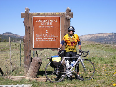
May 25. Dulce to Chama, over the continental divide which on this route is only 7850 ft. Forecast was 18 degrees in Chama, don't think it was this cold, but cold enough so we bundled up. More pretty high country. Got to Chama around lunch time, had burgers and beer in a saloon. Chama is a tiny town, not too touristy but the terminus of the Cumbres & Toltec Scenic Railroad that goes from here to Antonito Co. It just started up for the season last week. From Chama we went south ~20 miles to Heron Lake State Park and met back up with the support team.
The continental divide in northern New Mexico between Dulce and Chama. Not too impressive by Colorado standards. The sign says 7250 but the garmin and my maps say 7750.

The Brazos cliffs south of Chama.


May 24. Packed bare essentials for motel cycling and headed to Dulce, 70 miles. Pretty road, not much car/RV traffic but a lot of gas rig service trucks, since the Farmington gas fields are south and east of Farmington along this route. Stiff tailwind, pretty country through the Jicarilla Apache reservation. Stayed the night at the Jicarilla Best Western Inn and Casino. Don't know how they stay in business, but the rooms and food were OK. Had a good night's sleep in a real bed for the first time on the trip. Turned out Joe and Lou's truck just needed some hoses replaced that were leaking coolant onto the exhaust manifold. Didn't take too long so they drove over to Heron Lake State Park south of Chama where we were to meet up with them the next day.


Somewhere along the road to Dulce

Sunday, May 23, 2010

May 23. Spent the last couple days in the car. On Saturday drove from Monument Valley to Canyon de Chelly in a blasting sandstorm, blew a fender off the RV. Saw some dramatic canyon scenery but through a haze of sand and dust. On Sunday drove to Farmington NM through more 50 mph winds. Looks like the truck blew a gasket going up over the Chucksa mts. was overheating and boiling coolant through the exhaust headers. Joe and Lou will have to stay in Farmington for a couple of days to repair it. We are going to press on with the bare minimum in my panniers and bike from motel to motel for a couple of days. Trouble is, there aren't too many through this part of the country. Will say at Dulce NM tomorrow nite, probably stay at Abiquiu NM the next. Hopefully Joe and Lou will catch up to us on the way to Taos on the 3rd day. No new posts for the next few days since we won't be hauling any computers on the bikes. Bye for now.

Friday, May 21, 2010

May 21,
670 bike miles so far. We're staying in Monument Valley after a 58 mile ride mostly downhill and with the wind from Navajo National Monument to here. We got here in record time, almost beat our support team again! We rode our alternate bikes because in sections the shoulder on U.S. 160 east from Tuba City to Kayenta is pretty rough, with gravel, ruts and bad rumble strips that seem to compress your spine when you have to go over them. Just like yesterday, the roads were far from the remote Wild West of my imagination. Now it's the Winnebago West. There are caravans of Dutch tourists each with their mini RV's following each other around. It's the European's dream vacation. But I shouldn't talk, we're in an RV too. The road into Monument Valley doesn't have a shoulder and we were riding the white line with 75 mph traffic whizzing by - not a lot of fun. Took a 2 hr tour of Monument Valley with a local in an open-air pickup-wish those pics could load! It is a spectacular place. Towards the end of our ride and during our tour the wind picked up from the southwest and now it's a veritable sandstorm, we can't venture outside this evening. Tomorrow we are taking a break and driving to Canyon de Chelly for some more tourism. Probably no internet for a couple days.
Entering Monument Valley


One of many scenes from Monument Valley, too numerous to upload 'em all!


The dreaded rumble strips

May 20. 72 mile ride from Page AZ to somewhere on U.S. route 160 to the southeast. The plan was for our support team to pass us with water refills, travel ahead to Navajo National Monument, set up camp then come back to get us at the junction. This would have been 78 miles for us. We almost beat them to the junction - so got in where they passed us. Good thing we weren't perishing from thirst. I carry a little over 4 liters in my bottle holder and panniers, and Carrie carries a little over 3. Just as well they picked us up, 160 is a lousy road for cycling with bad shoulders and heavy traffic. In fact, the whole route today on a map looks to be through the middle of nowhere, but had a lot of traffic and a lot of big trucks. We climbed almost 4000 ft today summitting out twice at 6800 ft. Really another great day for cycling, in the mid 70's in the high desert with a brisk tailwind. Some good scenery, but mostly high desert sagebrush. Our camp at Navajo National Monument is a remote, beautiful, primitive camping area in the pinyon/juniper forest at 7400 ft -great views of rugged canyons, the best place we've stayed at all trip, and it's free! We had to rig up a shower by hanging a water bag from a juniper and using a tarp for a privacy screen, but it worked out just fine.

At camp in Navajo National Monument

A well deserved cold one after the toughest ride of the trip, from Page to Navajo National Monument.

Wednesday, May 19, 2010

Page, AZ


Rock formations in Buckskin Gulch, Utah


First, an addition to last night's post. We had dinner at a restaurant recommended by our friends Jim and Kelley, Houston's Trail's End Cafe in Kanab Utah. Talk about some great food, topped off by homemade pie. Jerry and Joe each enjoyed a bottle of Polygamy Porter. (Take some home to your wives, the label says).


Jerry atop a fun rock formation

Today we took a bit of a break. We rode 39 miles from Kanab UT to milepost 26 on route 89. From there we waited for the support team to catch up (they had to do the grocery shopping!) and then went for a hike up a canyon Jerry had been to before called Buckskin Gulch. The rock formations were so beautiful, lots of colors and wildflowers everywhere. We were hoping to get to the slot canyon but it was just too far away. It was really amazing.

Pretty flowers along Highway 89

Tomorrow an 80 mile ride scheduled with climbing involved; plan for an early start. We're traveling through Indian Reservation lands with primitive camping at the end; then on to Monument Valley. Not sure when we'll have internet again. Our weather's been beautiful, only rained on a little one night, sunny days and not too hot so far.

Tuesday, May 18, 2010


May 18. From UT state park south of Hurricane UT to Kanab. Writing from the Hitch'n post RV park in Kanab, quaint but with free WiFi!! 65 miles today, thru Zion Nat'l park. Had to get in the truck to get thru the tunnel going up the side of the canyon in the park. Cheated a little since we got an 8 mile ride and a couple thousand feet elev gain. Lots of climbing anyway, we summitted at 5700 ft at the east end of the park, dropped 1500 ft and climbed again to 6100 ft before we started the long downhill to Kanab. The cycling gods are with us, believe it or not we have had a tailwind almost all the way. Also, it's been partly cloudy and cool, perfect cycling weather. We've been going mostly south and east, but whichever way we go the wind is blowing uphill! We've gone 501 bike miles so far, well over 1/4 the way, and are in fine fettle. Only 2 flats, both Jerry's, Carrie hasn't had a problem yet. Looking forward to the Houston's Trails-End restauant tonite.
Tomorrow to Page but with a stop at Buckskin Gulch for some slot canyon hiking!


At the entrance to Zion. We waited for the RV so we wouldn't have to pay 12$ each to pedal 100 ft to the visitor's center. Zion doesn't allow bikes to go thru the tunnel so we had to get a ride up the canyon.Lunch in Zion with our top-notch support crew, Joe, Lou and Lotus Blossom!

May 17. Meqsuite NV to south of Hurrican UT on the way to Zion. 72 miles, 4300 ft elev gain, 4800 ft summit between Mesquite and St. George UT. Rode through 3 states, NV, AZ and UT. Nice route pretty scenic, especially the downhill side on the way to St. George. Perfect riding conditions, high thin clouds and only mid 70's temp. Sand Hollow St Park outside Hurricane is high and windy, but cool today.

Sunday, May 16, 2010

Sorry it took so long but we are too tired after long bike rides and internet access is spotty. Right now we are sitting in a casino lobby in Mesquite NV breathing the cigarette fumes because the signal is too weak at the RV campground. Long boring ride in the truck today from Mojave to here. We start back up on the bikes tomorrow, 4300 ft climb and 68 miles, sounds easy after 2 days ago.
May 12. Driveway to Los Banos. Milage: 101. Couldn’t be a better day for 100+ mile ride – flat, warm but not hot, 15 mph breeze at our back all the way. Cultural highlight was a tastee-freez at the combination Wienerschnitzel/Tastee Freeze in Tracy at 9:30 AM. Stayed at the Merced County Fair RV campground and dinner at a taqueria on Rt 152 in town that was pretty good.
May 13. Los Banos to 4 mi East of Lemoore. Milage: 103. Good riding conditions not quite as favorable a tailwind though. Route planned along canal was dirt and ‘authorized vehicles only’ so used plan B which also turned to gravel, but hardpacked and pretty smooth, also the most scenic route in the Central Valley – through a big wetland south of Los Banos where for ~12 miles only saw 1 car and lots of wildlife. Highlight was staying the night at ‘Red’s Roofing’ for free. He has an ‘escapees’ RV hookup that is listed in the Escapee’s club to which my in-laws belong. He’s an eccentric character of about 75 year, who’ll talk your ear off but has a heart of gold and lives in a real garden spot in the country. We had strawberries, cherries and grapefruit from his garden and orchards, and great hospitality.
Dirt road detour on our road bikes.

May 14. Lemoore to Bakersfield. Milage: 92. Boring flat road but a good tailwind – got up to 25 mph on a flat course! Due to mis-info of some kind, overshot our RV site by about 12 miles, which is the length of Bakersfield east-to-west. Joe and Lou came to pick us up at a Taco Bell where we were cooling our heels and brought us back to the RV site. We will be dropped off where we started tomorrow so we won’t have to repedal the 12 mi. They have to fix the truck AC so we may be pedaling to a motel in Tehachapi tomorrow.
Lunch in an orchard north of Bakersfield

May 15. Saturday Milage: 67.5 elevation change 5100 feet. We went from Bakersfield to Mojave today via Tehachepi Pass. BEAUTIFUL RIDE! Wildflowers, great horned owl, 2 rattlesnakes! Long slow climb up the pass via Woodford/Tehachapi Road to the town of Tehachapi, then up and over the pass itself. Then down the fun descent to Mojave for a well deserved Margarita while waiting for the Support Team (thanks Mom and Dad). Dad’s truck A/C fixed to go over the desert tomorrow. Had dinner at a truly wonderful Mexican Restaurant La Conquistadora.
Road hazard in Tehachapi foothills


Finally in the desert near Mojave

Saturday, May 1, 2010

Down to the wire

Well, we're almost set to begin. We have a tentative start date of May 12th, if all goes according to plan. Mom and Dad are well on their way and should be here soon, the bikes have been serviced, and I think we've bought everything we need. Now we just have to finish up at work and it's off we go! Jerry did a 56 mile ride today with 4000 foot elevation change (i.e. big hills). My bike is still being worked on so I couldn't go with him but I've been training well all winter and am as ready as I'll ever be, I think! I still have to get my new Garmin 650 bike computer to talk to the laptop so we'll be able to navigate our way on the road. Hopefully that will happen this weekend.